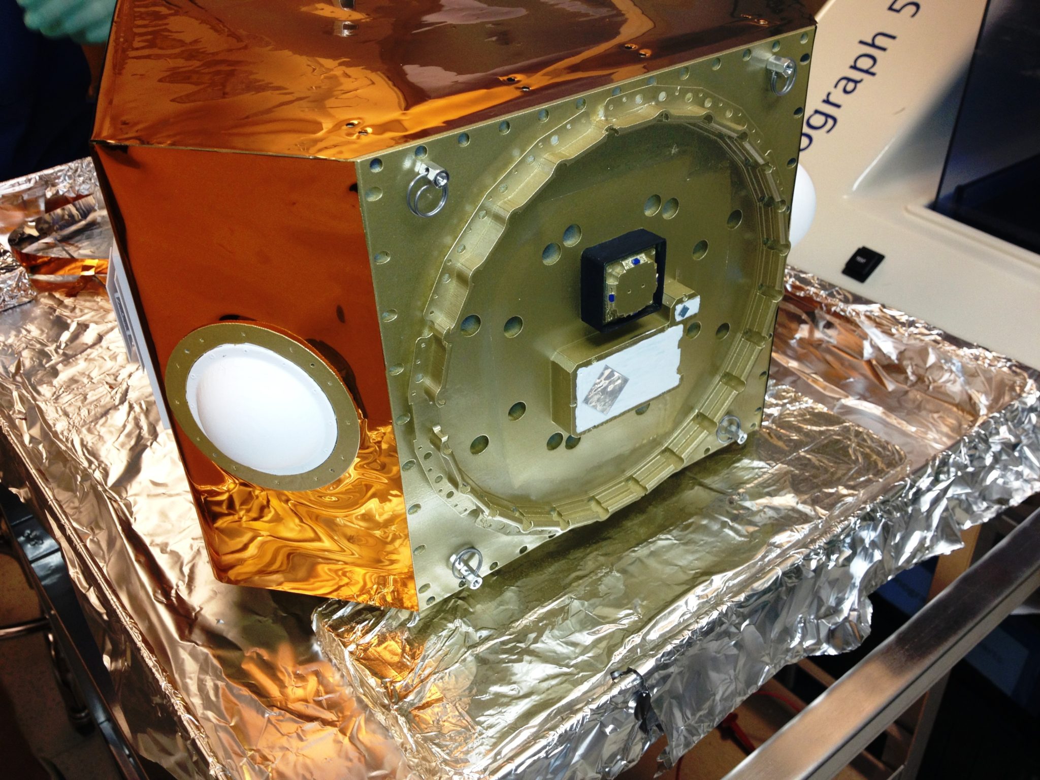
A half to scale CICERO model in assembly. Photo: GeoOptics
[Via Satellite 01-23-2015] Commercial environmental data company GeoOptics is in the process of establishing partnerships to support, build and launch a constellation of Low Earth Orbiting (LEO) small satellites called the Community Initiative for Continuous Earth Remote Observation (CICERO). The company’s plan is to launch the satellites six at a time, leading up to an initial constellation of 24 spacecraft.
CICERO’s purpose is to provide Radio Occultation (RO) data to measure atmospheric temperature, moisture, and pressure to better predict weather phenomenon on Earth. GeoOptics’ satellites are designed to be very simple, focusing on receiving signals from Global Navigation Satellite Systems (GNSS) as they pass through Earth’s atmosphere.
“We continue the process of identifying partners and solidifying agreements with various value-chain partners as we pull our business together. We have recently continued to advance our relationship with a satellite-manufacturing partner,” Jon Kirchner, president of GeoOptics told Via Satellite. “There are other partners that we have and that we’re putting together both on the ground infrastructure side for processing data, there’s the actual retrieval of the data which we have an identified partner for … and on our data processing as well.”
Raising capital for the CICERO constellation pushed back its debut, which was previously planned for 2014. Kirchner said the company plans to begin launching satellites within 18 months of completing funding. The satellites have a target weight of less than 100 kilograms and Virgin Galactic is contracted to deliver GeoOptics’ spacecraft to orbit using LauncherOne.
Kirchner admitted funding has been a challenge, but said the company is gaining momentum as the U.S. National Oceanographic and Atmospheric Administration (NOAA) takes steps toward implementing commercial weather data.
“NOAA did its gap mitigation study back in the spring [of 2014], and it’s RFI for GNSS-RO data back in autumn. Those are buying signals — particularly the RFI — that we think are quite significant, and the investor community takes onboard as significant. We are seeing a positive turn in terms of investor interest, which frankly will kick off with what I would call the “bending of metal” in terms of building satellites,” he said.
GeoOptics CEO, Vice Admiral Conrad Lautenbacher, Jr. was the administrator of NOAA from 2001 to 2008, when the agency began to evaluate commercial sources of weather data. Lautenbacher told Via Satellite that NOAA culture did not originally support buying data it did not produce, but during his tenure this began to change. NOAA now regularly incorporates ground based weather data such as lighting and Mesonet. He anticipates the same change will soon follow on the satellite side.
“The shift was prompted by both the increasing recognition by NOAA that we did not have the resources to duplicate private sector investment, and the realization that quality control and availability issues could be handled by properly constructed contracting regulations. Once NOAA personnel became accustomed to buying, certifying and incorporating commercially produced data like lightening and imagery data under appropriate policies and regulations, it became more or less a fixture within the organization,” he said.
So far the agency has already been prompted to make better use of commercial weather data in addition to its own resources with pressure from congressmen like Jim Bridenstine, R-Okla., to leverage private options to stave off the risk of gaps in data. In the agency’s Request for Information (RFI), issued in September 2014, NOAA said it is seeking opportunities to equip satellites in the polar plane of COSMIC 2 — a joint mission between NOAA and Taiwan — with RO receivers. This could result in a public-private partnership where a company would provide RO receivers for NOAA to integrate with the FORMOSAT spacecraft to complete the COSMIC 2 constellation.
COSMIC 2 consists of 12 satellites, with six orbiting equatorially and six in polar orbits. Kirchner said GeoOptics is a staunch supporter of the global RO community, including COSMIC 2, and sees it as more of an opportunity than a potential cannibalizer of the company’s business.
“We will help the government augment its decline in availability of RO by putting in place commercially 2,000, then 8,000 and 20,000 soundings [per day] in relatively short order. And then when COSMIC 2 [polar] comes to play, which will probably be in 2018-2019, this will add 4,000. By the time we get to 2019 we would probably have 20,000 to 30,000 already in orbit,” he said. “The RO community is going to be thrilled with that kind of volume.”
GeoOptics recently completed an Observing System Simulation Experiment (OSSE) with its partner Atmospheric and Environmental Research (AER), which found that a constellation of hundreds of GNSS-RO receivers would have the ability to significantly improve mid to long term forecasts. Kirchner said the study also proves the value of RO data on a more granular level that could open up opportunities internationally.
“There is a clear and present regional forecasting efficacy and utility that dense RO provision yields,” he explained. “Because of that we see the need and the opportunity to talk to individual countries who are much smaller than the United States, or have weather sensitivities that are as great as the United States — those are the kinds of countries that are expressing the interest.”
The post GeoOptics Continues Constellation Preparations Through New Partnerships appeared first on Via Satellite.